


Garth-Johnson's Store, Jackson County, Alabama
About
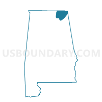
Outline

Summary
| Unique Area Identifier | 521977 |
| Name | Garth-Johnson's Store |
| County | Jackson County |
| State | Alabama |
| Area (square miles) | 21.08 |
| Land Area (square miles) | 20.99 |
| Water Area (square miles) | 0.09 |
| % of Land Area | 99.59 |
| % of Water Area | 0.41 |
| Latitude of the Internal Point | 34.73528130 |
| Longtitude of the Internal Point | -86.32042210 |
Maps


Graphs
Select a template below for downloading or customizing gragh for Garth-Johnson's Store, Jackson County, Alabama


Neighbors
Neighoring Voting District (by Name) Neighboring Voting District on the Map
- Gurley City Hall, Madison County, AL
- Hollytree-Morris's Store, Jackson County, AL
- Maysville Church of Christ, Madison County, AL
- Paint Rock Senior Citizen Center, Jackson County, AL
- Trenton Fire Hall, Jackson County, AL
- Woodville City Hall, Jackson County, AL
Top 10 Neighboring County Subdivision (by Population) Neighboring County Subdivision on the Map
- Gurley CCD, Madison County, AL (15,745)
- New Market CCD, Madison County, AL (14,871)
- Paint Rock CCD, Jackson County, AL (3,518)
- Princeton CCD, Jackson County, AL (2,119)
Top 10 Neighboring Place (by Population) Neighboring Place on the Map
Top 10 Neighboring Unified School District (by Population) Neighboring Unified School District on the Map
Top 10 Neighboring State Legislative District Lower Chamber (by Population) Neighboring State Legislative District Lower Chamber on the Map
Top 10 Neighboring State Legislative District Upper Chamber (by Population) Neighboring State Legislative District Upper Chamber on the Map
Top 10 Neighboring 111th Congressional District (by Population) Neighboring 111th Congressional District on the Map
Top 10 Neighboring Census Tract (by Population) Neighboring Census Tract on the Map
- Census Tract 102, Madison County, AL (5,516)
- Census Tract 9505, Jackson County, AL (3,518)
- Census Tract 109.02, Madison County, AL (3,124)
- Census Tract 9504, Jackson County, AL (2,119)